Land Cover & Canopy Assessment
Generate summaries of heat by land cover, tree canopy, or land use to examine trends and opportunities to influence land development and zoning policy. Understand how vegetation and surface materials influence heat trends in your area.
Deliverable
Report detailing relationship between land cover, tree canopy, and heat, spatial assets with metadata.
Process
Analyze the relationship between natural hazards of concern and up to 10 land cover classes.
Impacts
Evidence base
Adaptation insights
Development targets
Report Sample
(Click for high-resolution PDF)

Project Example
Pierce County, WA

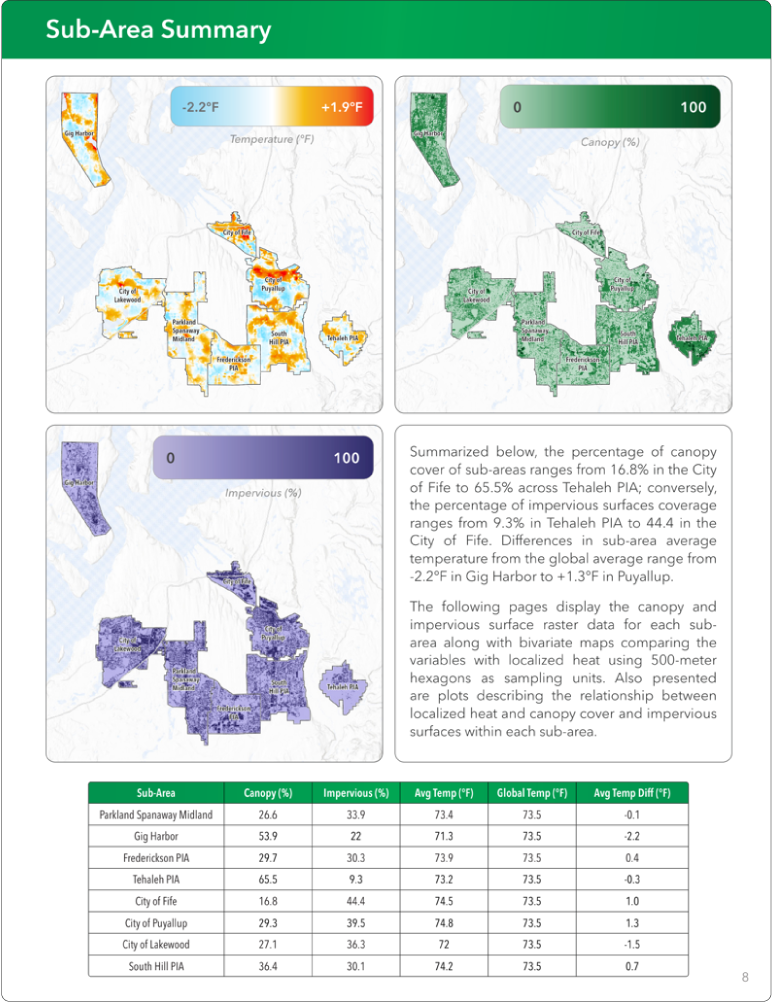
CAPA conducted a canopy analysis for Pierce County, using tens of thousands of heat measurements collected by community members during the summer of 2024 via the CAPA Heat Watch mobile mapping campaign. The analysis assessed the relationships between heat, existing canopy cover (34% area-wide), and impervious surfaces (30% area-wide). This assessment was performed at both the scale of the entire study area and within eight specific sub-areas, revealing patterns like cooler zones in high-canopy parks and warmer zones in high-impervious industrial areas. The analysis resulted in spatial data products and specific recommendations for Pierce County, identifying opportunities for targeted heat mitigation actions such as prioritizing canopy expansion in hot, low-canopy areas, reducing impervious surfaces, and implementing non-vegetative shade solutions.
Check Out Our Other Services


Air Quality Monitoring
Extreme Heat Projections
Intervention Guidebook